-
Title
-
[Map depicting Brobdingnag]
-
Description
-
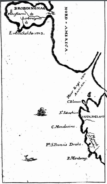
The image depicts the fictional land of Brobdingnag, off of North America. The cities of Flagnlamic and Lorbrulgrud are shown. Underneath Brobdingag reads “Entdecket Ao. 1703”, meaning “Discovered in 1703”. The bottom half of the map includes New England. A ‘man-of-war' ship is shown off the coast of New England, and a dolphin is near the bottom of the image. The map in this edition is the same as that in the 1727 German von Wiering edition.
-
Image Creator
-
Anonymous (Engraver)
-
Identifier
-
mta:26889
-
Source Name
-
Des Capitains Lemuel Gulliver’s Reisen in unterschiedliche entfernte und unbekannte Länder
-
Image
-
mta_26889_OBJ.jpg
-
Subject
-
Gulliver
-
Travels
-
Imaginary Places
-
Fictional Works
-
Maps

 mta_26889_OBJ.jpg