-
Title
-
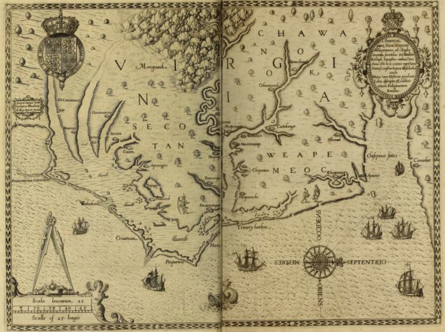
The carte of all the coast of Virginia
-
Description
-
An illustrated map of the land the English colonists called Virginia (today North Carolina). Several Indigenous towns are labelled on the map.
-
Image Creator
-
Theodor de Bry (Engraver)
-
John White (Painter)
-
Johann Wechel (Printer)
-
Identifier
-
mta:20561
-
Source Name
-
A briefe and true report of the new found land of Virginia, of the commodities and of the nature and manners of the natural inhabitants. Discouered by the English Colony there seated by Sir Richard Greinuile Knight in the yeere 1585. Which Remained under the gouernement of twelue monethes, at the speciall charge and direction of the Honourable Sir Walter Raleigh Knight lord Warden of the stanneries who therein hath beene fauoured and authorised by her Maiestie and her letters patents
-
Image
-
mta_20561_OBJ.png
-
Subject
-
Coasts – North Carolina
-
United States – historical geography - Maps
-
Indigenous peoples – Virginia
-
Algonquians

 mta_20561_OBJ.png